File:Interstate 30 map.png
Jump to navigation
Jump to search

Size of this preview: 800 × 450 pixels. Other resolutions: 320 × 180 pixels | 640 × 360 pixels | 1,024 × 575 pixels | 1,280 × 719 pixels | 2,205 × 1,239 pixels.
Original file (2,205 × 1,239 pixels, file size: 120 KB, MIME type: image/png)
Summary
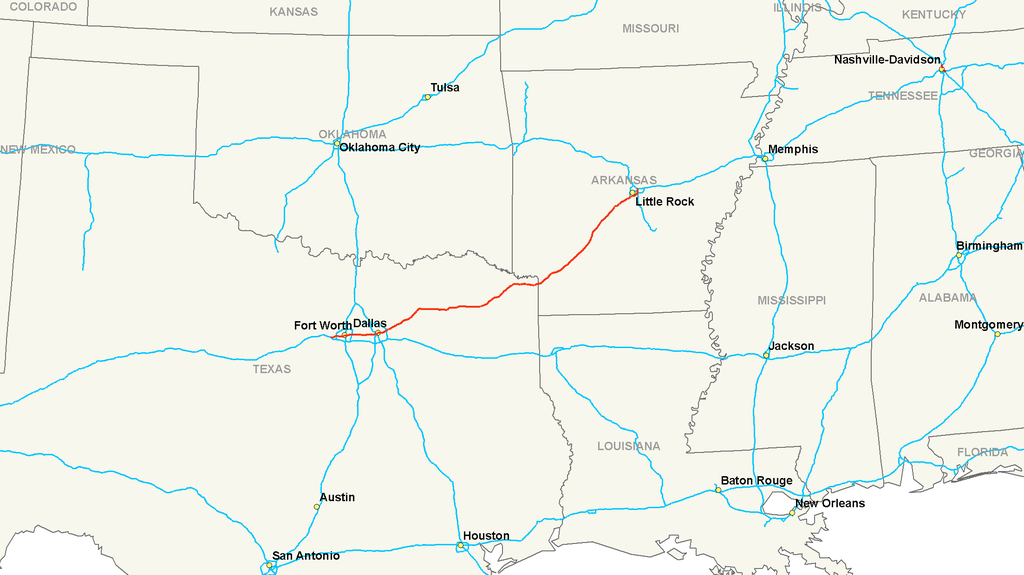
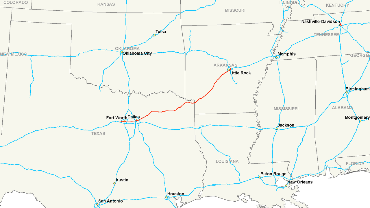
| Description | Map of Interstate 30 |
| Date | |
| Source | Own work |
| Author | Nick Nolte |
| Permission (Reusing this file) |
Public Domain |
Licensing
I, the copyright holder of this work, hereby publish it under the following license:
| This file is made available under the Creative Commons CC0 1.0 Universal Public Domain Dedication. | |
| The person who associated a work with this deed has dedicated the work to the public domain by waiving all of their rights to the work worldwide under copyright law, including all related and neighboring rights, to the extent allowed by law. You can copy, modify, distribute and perform the work, even for commercial purposes, all without asking permission.
|
File history
Click on a date/time to view the file as it appeared at that time.
| Date/Time | Thumbnail | Dimensions | User | Comment | |
|---|---|---|---|---|---|
| current | 05:46, 14 July 2006 | | 2,205 × 1,239 (120 KB) | wikimediacommons>Stratosphere | {{Information |Description=Map of Interstate 30 |Source=Own Work |Date=July 13, 2006 |Author=Nick Nolte |Permission=Public Domain }} |
File usage
The following page uses this file: